


DESIGN
- quarries, mines, environment restoration
- landslide structural works
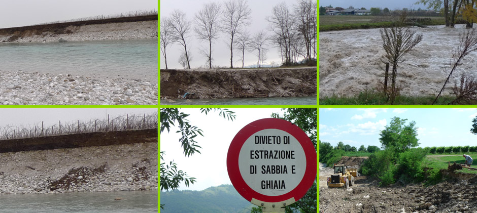
- hydraulics and river control works
- roads and infrastructures
- environmental authorisations
- ental impact assessments
RESEARCH AND DEVELOPMENT
- the company supports the software
department of Virtualgeo s.r.l. to
develop new technologies for territory
management and design, and for
environment monitoring
- the company carries out research
and development projects in the
environment and renewable energy fields
DISSEMINATION
- the company takes part in national
and international seminars and
university master’s courses to
disseminate (with three-dimensional
systems and stereoscopic vision) the
researches on new technologies for
environmental design and management

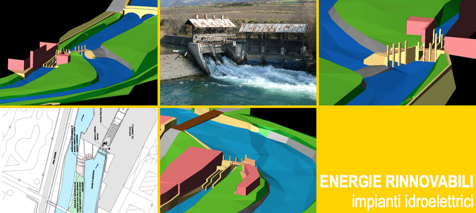
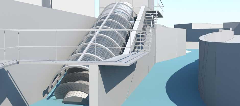
HYDROELECTRIC POWER PLANTS
(with hydrodynamic screw or other type of turbines)
- analysis and audit for site capacity
- preliminary, final and conceptual designs
- management of administrative procedures
- structural analysis, building site and
security management
- testing
- connection to electricity network
- management of application for
renewable incentives
PHOTOVOLTAIC AND BIOMASS PLANTS
- feasibility study
- plant design
- management of administrative procedures
- air emissions analysis and noise
impact assessment
- conceptual design
- building site management
- connection to electricity network
- management of application for
renewable incentives
ENERGY EFFICIENCY
- energy auditing
- feasibility study and design for energy
saving solutions
- thermal imaging and data
interpretation
- thermal imaging and laser scanning
for buildings
- 3D modelling of thermographic data

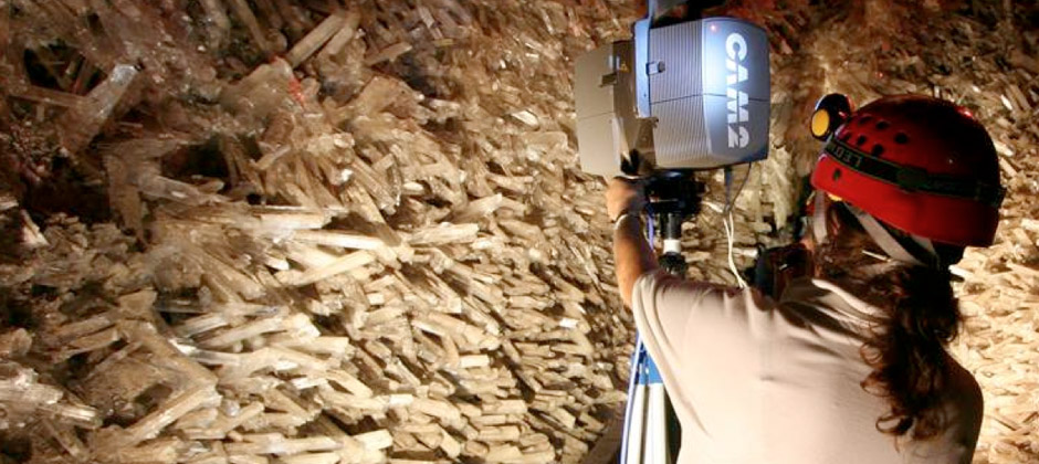
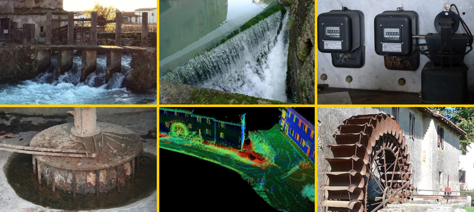
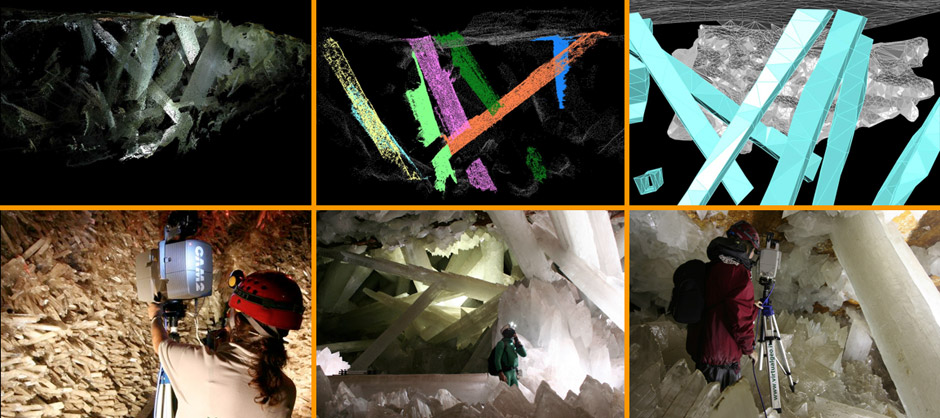
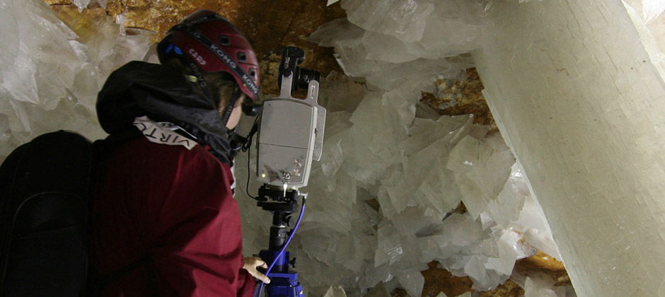
SURVEYS WITH LIDAR SYSTEMS
- three-dimensional surveys by 3D
laser scanner (airborne and terrestrial)
- underwater three-dimensional
surveys by interferometry
SURVEYS AND MONITORING
- traditional topographic surveys
- GPS surveys
- periodic or continual rock wall,
landslide, or structure (tunnels,
viaducts, etc.) monitoring
- management and installation of
monitoring systems
3D MODELLING AND CARTOGRAPHY
- three-dimensional modelling and
reverse modelling of laser
scanner point clouds
- 2D graphic representations and
3D information models
(Virtualgeo’s CloudCUBE and
EasyCUBE software technologies)
